Land Management Bureau, RASA Surveying Instruments, hosts surveying instruments training for DENR employees
To enhance the proficiency of personnel involved in survey and mapping, the Land Management Bureau (LMB), in partnership with RASA Surveying Instruments, organized a technical training event focusing on modern surveying instruments. Held from April 17 to 19, 2024 at the RSI Building in Tandang Sora, Quezon City and UP Baseline in UP-Diliman, the event aims to equip participants with advanced skills and techniques in utilizing the Global Navigation Satellite System-Real Time Kinematic (GNSS-RTK) and Total Station technologies.
The training was participated by the technical personnel from the Surveys and Mapping Division (SMD) of all the Regional Offices of the Department of Environment and Natural Resources (DENR), and the DENR Bangsamoro Autonomous Region in Muslim Mindanao (BARMM).

In his welcome remarks, LMB Geodetic Surveys Division (GSD) Chief Engr. Bienvenido Cruz encouraged the participants to use the lessons learned in ensuring efficiency and accuracy to minimize errors in surveying. He also emphasized the need to share their acquired knowledge during the training to their fellow DENR employees.
Over the course of the three days, participants were immersed in both theoretical knowledge and practical experience.
It was structured to cover various aspects of modern surveying instruments, including:
- Basic Introductory Training: Participants underwent introductory sessions aimed at familiarizing them with GNSS-RTK and Total Station instruments. Topics covered included an overview of accessories, package components, and discussions on applications and specifications.
 |
 |
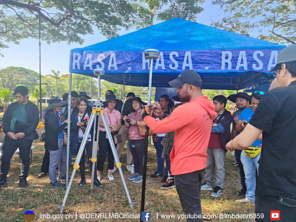
2. On-site Training: A key feature of the event was the hands-on training sessions conducted on-site. Here, participants had the opportunity to gain practical insights into the components and usage of GNSS-RTK and Total Station instruments. Experts provided guidance on operational techniques and shared best practices for data collection and analysis.
 |
 |
As the demand for precision and reliability in surveying practices continues to grow, initiatives such as this play a crucial role in advancing the capabilities of surveying professionals. By embracing modern surveying instruments and technologies, participants are better positioned to ensure the accuracy and legitimacy of land tenure systems, and to mitigate the risks of fraudulent titling.