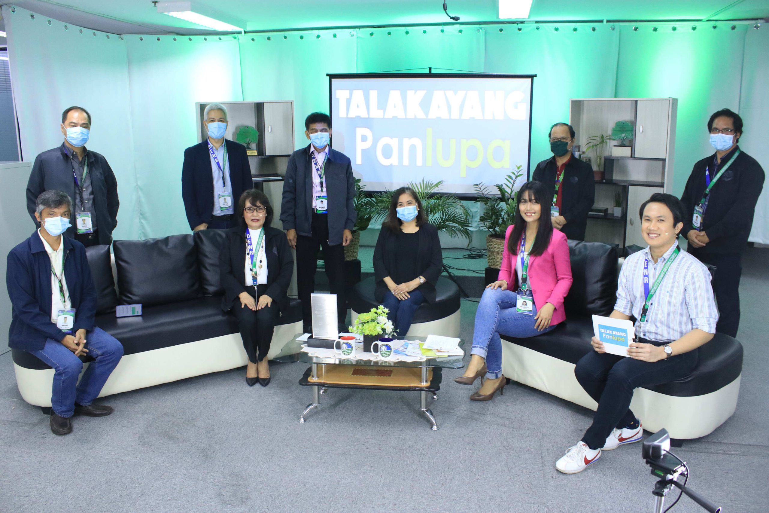
LMB explores new window for public service with ‘Talakayang Panlupa’
(FIRST ROW, L-R: Chief, Land Policy and Planning Division, Engr. Henry P. Pacis, Chief, Legal Division, Atty. Marlou P. Alutaya, Director, Atty. Emelyne V. Talabis, Engr. Genalyn E. Verbo, and Mr. Martin Lorenzo O. Alba ; SECOND ROW, L-R: Chief, Land Management Division and Head, Administrative Support Staff, Mr. Alex C. Pascua, Chief, Records and Knowledge Management Division, Engr. Victor B. Balde, Assistant Director, Engr. Romeo P. Verzosa, Chief, Geodetic Surveys Division, Engr. Bienvenido F. Cruz, and Chief, LPPD-ICTS and Head, LAMS-NCD, Engr. Warlito G. Quirimit)
Life has been hard for many during this pandemic. Even the services that the government provides to the public were affected by the lockdowns and required physical distancing.
To adapt to the new normal and as its way of reaching out to the public, the Land Management Bureau (LMB) aired the first episode of Talakayang Panlupa live on its official Facebook page last September 9, 2020. Talakayang Panlupa is an online talkshow produced by LMB as part of its 119th founding anniversary celebration to discuss the different concerns of the public regarding land matters. With the help of various land experts, this show aims to give clarity regarding the various issues about land administration and management in the Philippines.
For its pilot episode, the show tackled the history, mandate and functions of the Land Management Bureau with the help of Assistant Director, Engr. Romeo P. Verzosa, Chief, Legal Division, Atty. Marlou P. Alutaya, and Chief of Land Policy and Planning Division (LPPD), Engr. Henry P. Pacis.
Atty. Alutaya briefly discussed the history of LMB which started as Insular Bureau of Public Lands in 1901 and became Bureau of Lands in 1905. According to her, the main function of the Bureau of Lands then as a line agency was focused on surveying and disposition of public lands in the Philippines. “Nuong una, lahat ng cadastral surveys at application for patents ay ang Bureau ang nag-aapprove.”, she mentioned.
However, in 1987, the Department of Environment and Natural Resources (DENR) went through a re-organization by virtue of Executive Order 192 which paved the way for the establishment of now Land Management Bureau. With this, most line functions of the Bureau such as approval of cadastral surveys and survey plans were decentralized to the Field and Regional Offices.
“Sa ngayon, ang Land Management Bureau, as we know it, ay naka-focus na sa paggawa ng policies and programs ng DENR na tutulong para mapabilis ang mga proyekto ng gobyerno sa pagpapa-titulo ng lupa. Lahat po ng serbisyo sa pag approve ng survey plans at pag issue ng patents ay nasa mga Regional and field offices na.” Engr. Henry stated. Nevertheless, there are still residual functions left under LMB such as the disposition of friar lands, patrimonial properties, tulad ng Proclamation No. 172 sa Taguig.
According to Engr. Verzosa, as per data collected, out of the 14 million hectares of Alienable and Disposable (A&D) lands in the Philippines, around 70% has been issued patents. Improving tenure security is among the Socio-Economic Agenda under the Administration of President Rodrigo Roa Duterte and also one of the 10 Priority Programs of DENR Secretary Roy A. Cimatu.
Moreover, in its initial episode, Engr. Verzosa briefly discussed what cadastral survey is all about. As of 2016, the cadastral survey in the whole Philippines was completely done.
Another important highlight of this episode was the reiteration of LMB strategies in coping up with the fire incident which happened last 2018 at the LMB building in Manila, as well as in adapting to the new normal brought by the pandemic. One of strategies discussed was strengthening the digitization of land records through the Land Administration and Management System (LAMS).
Engr. Verzosa also highlighted that due to the pandemic, LMB is now accepting online requests through its official Facebook page , website, email address and telephone numbers, as well as services from couriers so as to lessen physical contact and maintain safety for the public and agency as a whole.
Additionally, the land experts also discussed the distinction among the different land administration agencies such as the Department of Environment and Natural Resources (DENR), Department of Agrarian Reform (DAR), National Commission on Indigenous People (NCIP), and Land Registration Authority (LRA).
“Maganda ang intensyon ng mga ahensyang ito ng government para i-recognize lahat ng rights ng mga tao.. Pero syempre sa pag operate sa field, eh nagkakaroon din ng complications sa requirements at overlaps to jurisdiction. Ang maganda lang nito lahat naman ng titulo ay nare-register sa iisang ahensiya – ang Land Registration Authority (LRA), sa pamamagitan ng kanilang Registry of Deeds (RoD). Kaya importante na magkaroon ng coordination or sharing of data ang mga ahensiyang ito,” Engr. Pacis added.
Furthermore, Engr. Verzosa mentioned the on-going discussion between DENR-LMB and the LRA regarding the sharing of land information database. “Sa pamamagitan nito mapapabilis ang transaksyon ng publiko lalo na sa paghahanap ng technical description at status ng lupa,” he said.
Lastly, Engr. Verzosa also reminded the public about the Agricultural Free Patent Act which will expire on December 31, 2020. With this, the land experts encouraged the public to apply for Agricultural Free Patent before the year ends at the nearest DENR Regional Officers and Community Environment and Natural Resources Offices (CENROs).
Before the program ends, several questions from the public regarding the episode’s subject matter were answered. You can catch the whole episode 1 of Talakayang Panlupa on LMB Official Facebook Page (DENR – Land Management Bureau) and stay tune on the upcoming episodes every Wednesday of September 2020 at 10:00 AM.

